Wednesday, May 21, 2008

The Desert and the Anasazi - Lavender Canyon

The cliffs and mesas on the Colorado Plateau are a unique place with unique qualities. The red walls peel away memory – the memory of other places, of other times, and even the memory of self until all that is left is this space – this red cathedral and the thousands of years it whispers of in a thundering, but empty and still crescendo. The cliffs rise as memories fade.

Although I have not wandered in these canyons for almost a year, the intervening time is stolen – filtered in the sands - lost. That year fades like a single drop of sweat on hot Navajo Sandstone until even the feeling of memory is lost. Now, this place, this time is all I have; all I know; and all I desire - a jealous lover whose beauty bares no wayward glance and whose caress steals the heart – forever. It is also best to pay attention to this lover in the heat of summer or she will have her vengeance.


I have journeyed here again to find the anasazi, to wander in the beauty of the desert, and to lose myself; to let sun bleach my soul, to filter it through the hot sand and to have the ancients return it to me cleansed and clear. They have walked here until decades are measured in moments — they know the paths, the secret places, and the beginning and end of a footstep and the sum of a life. Perhaps the solitude here is part of the revelation - the serenity drives a kind of relentless introspection.

I lean heavy against the red escarpment as if to push it away like great Atlas or Hercules - palms outstretched, fingers pointed toward the sky, back bent, head bowed. The moments slip and I think about these things. The week lies ahead. Eventually, I pull away and stand erect. The moisture of my palm prints, much like the painted palm prints of the Anasazi, traces the outlines my hand. Another journey begins -discovery in many forms awaits.


Lavender Canyon lies between Bridger Jack Mesa and Salt Creek Canyon on the south side of Canyonlands National Park. I wished to explore the upper and deeper part of the canyon because of its proximity to Salt Creek Canyon. Tammi and I had been backpacking down Salt Creek a couple of years back and were surprised by the number of ruins and gliffs. Salt Creek has the largest ruin outside of Mesa Verde (Big Ruin) and is home to such famous pictographs as All American Man and the Four Faces.

Lavender Canyon was named after David Lavender. Twice nominated for a Pulitzer prize this rancher and all-around western man; who was mostly a hard scrabble cowboy, put his mark on western history and literature. Near Durango, as a young man, he worked a silver mine and on his stepfather's cattle ranch as a cowboy, helping with all the work until a drought and the Depression forced the ranch's closure. Near to my heart he was also an avid mountaineer. Among other things, he was a Princeton grad. He later became a dedicated conservationist. He realized the west he knew was dying and the result of this realization was his most well-read book which was published in 1943, "One Man's West". The book is in reprint by Bison Books and out in a new edition with notes and added material by David Lavender's son, David G. Lavender.

Armed with a permit you can drive into Lavender Canyon from Canyonlands, but that approach is best for uninitiated and untested. It is best approached from the most south-southwestern side of Bridger Jack Mesa. The 4x4 road that leads north around the west side of Bridger Jack makes for an easy passage, but it is a bit narrow. I don't know the name of the Mesa the road sits on (it is unnamed on the topo), but the camping on the Mesa is fine. Let's call it Little Bridger Jack Mesa. The mesa burned quite some time ago, so the top is mostly grass and offers easy going. I found the reason for the fire on the way back up. There is an old uranium mine just off the cliff on the southwest corner. It looks like the miner's camp was the source of the fire.

The way down off Little Bridger Jack is hard and the way up even harder, but it does make a good day's walk. You can also get down Dry Fork Canyon - I walked around to look off the side and the way is quite easy. The north end of Little Bridger Jack looks passable on the topo, but the lower wall can not be breached without a rope.

Lavender Canyon is deep and the walls consistently vertical. The first picture shows the central part of the canyon - about 1000 foot from the mesa top to the creek at the bottom. There are ruins in the canyon and some looking around will reward a good search; however, the wild parts of the canyon are pristine and the wildflowers were wonderful - Shooting Star, Pestemon, Desert Indian Paintbrush, coreopsis, and plenty of blooming cactus.

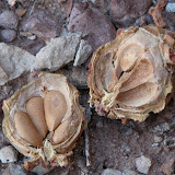
In a side canyon I found fresh cougar track, the rear paw measuring just over 4" wide. He was a big boy and I was weary coming back at dusk that evening. A few deer tracks and a bit of water gave up the reason for his night's vigil. (I've looked at this picture a few times and sometimes get the illusion that the print is "pushed up", not in to the soil - if you get that look again) There were few signs of the usual leftovers of Anasazi habitation in the canyon itself. Although the Anasazi did live here I suspect the times were shorter and the water and game scarcer. I saw no gliffs except at the ruins; however, there are more than likely some around. The wall are generally dead vertical too - there simply aren't many building sites.


As soon as I got near the lower parts of the canyons the deer flies began to attack in hordes. I nearly went crazy slapping and swatting and Deet didn't make any difference whatsoever. I eventually put on pants and the incessant biting stopped - the horde just swarmed my legs. I seldom wear pants in the desert, but from now on in June I think I will always wear them. The gnats and no-see-ems were no fun either. I'm still itching a week later.

Besides the canyon itself there is another reason to visit; Cleft Arch. Cleft arch is a graceful and massive arch, thick and even, wide and tall. It juts into the the canyon and demands a visit. I approached it from the south and begin to friction the lower steep slaps and faced climbed the remainder. It can be free climbed, but it took me some time to work it out and I am a fairly experienced climber (the face: friction -5.9, face - 5.7/8). I recommend the northern side as it provides only a steep walk. Begin up thru the narrow slot when you first see the northern side of the arch. Of interest is the arch itself - its name becomes apparent once inside. It is now actually two arches joined together by a narrow, but very deep cleft no more than 1/2" wide. Lying on the hot sand blue sky is visible thru the vertical shaft, which must be 30 or more feet thick.


I walked and explored throughout the day and in the afternoon periodically sought some shade as I began to overheat. The canyon become hotter and the little thermometer on my pack strap soon slipped to 110 degrees. The afternoon, the sand, the ceders, the cactus, and the terrain turned against me. I had gone too far, climbed too much and still had much of the mesa to ascend to get to camp. I ran out of water and I had started with 200 oz - more than 1-1/2 gal. The setting sun gave me respite from the heat and I struggled slowly up the last 700 foot of Little Bridger Jack Mesa, through the cliff bands, and made my way toward camp. I had suffered a good bit in the end, but the day was worth the effort. The thirteen-hour exploration had left its mark and tomorrow I would drive to Beef Basin. Here's how David Lavender said it:

"Fortunately God gave man a poor memory for physical discomfort. The active ingredients which made the hurt so brutal at the moment lose their keen edge in retrospect: we are able to look back on them with certain detachment and even make them subject matter of our dearest conversation pieces."


These canyons don't yield their beauty easily - especially in late June and the home of the Anasazi is seldom hospitable. Discovery is never easy - any kind of discovery.


Correction! I had read that Lavender Canyon was named for David Lavender, but according to a much better source, David G. Lavender (the writers grandson), Lavender Canyon is named for Ed Lavender (David Lavender's step-father). Apparently, Ed used to drive cattle he bought from Ed Scorup ( the then owner of the Dugout Ranch on Indian Creek now just outside Canyonlands National Park). See page 328 of the new edition of "One Man's West". Anyway, I'll keep the post - surely Ed would approve of his son's fame.

Saturday, February 02, 2008

Ishi

I was in a used bookstore in Gunnison not too long ago and found a book I've been interested in reading for a while. Published in 1961, the book is a fascinating account that terminates a part of western history with a viscerally and debilitatingly sad ending.

In August 1911 an emaciated Indian stumbled out of the Neolithic world near Mill Creek on the Mt. Lassen (in his language - Waganupa) foothills and into the brilliant lights of the twentieth century. Save from an old covered wagon cloth that he wore over his shoulders like a poncho, he had no modern object. He spoke no English, not a word. In fact, he had never had any contact with any white man whatsoever. (Except for some tragic contacts that we'll delve into later.)

He was the last wild Indian.

Ishi's life is one of tragedy and sadness and his story - more than any bloody massacre, more than Sand Creek, more than the Trail of Tears, and more than the gut wrenching emotion behind Chief Joseph's last lament; "I will fight no more forever" - shows us who we were and what we did. He was the Mohicans, he was the Apache, he was the Nez Perce, and he was the Blackfeet, but more tragically so. For the Yana, (Ishi's people) are unknown - they were quite simply exterminated until only one remained - Ishi.

The Yana had lived in about a 2000 sq. mile area around Mt. Lassen for about 2- or 3000-years. This number is surmised from the glottochronology. In an area smaller than Rhode Island they had lived so long that four separate dialects from the Hokan had developed - some not intelligible to other. Of interest is that the Yana language was sex-differentiated; that is, that the men spoke a different language to the woman than to each other. For example, the word grizzly bear, t'en'ta spoken by the males was t'et in the female language. The woman no doubt knew the male language, but did not speak it as the men spoke in the female language to the women.

When Ishi was born in about 1862 the Yani had already been hunted for many years and the southern group (the Yahi), Ishi's band, was thought extinct. The white men had killed or enslaved many thousands of Yani. However, a small family group had survived which included Ishi's mother and sister. This small, terrified group, unbelievably, had remained hidden for almost forty-years. Until, that is, a small group of men stumbled upon their hidden camp. Ishi's mother was left behind because of age and infirmary. The rest scattered. Even with the sick women present the men took all the food and tools. They left nothing. Ishi never saw his sister again and assumed she was killed; however, she most likely starved or was killed by wild animals. Without food and stores Ishi's mother died. Ishi morned his mother and now he was alone. The last Yahi - the last pure Indian.

He lived in this state until he walked out in 1911.

His story is told here in shortened version. Google Ishi - there's a lot of stuff out there and it's worth reading.

Ishi in Two Worlds - A Biography of the Last Wild Indian in North America, Theodora Kroeber

Sunday, October 21, 2007

The Department of State and Me

On October 13th, just after lunch, someone from Reston VA did a Google Search for "artis brazee". They found, among other things, my Blog. They spent about 8 minutes on "thoughts from the wrong side of the brain" and viewed every page of my Blog, now almost 80 posts. Their IP address was the Department of State, which is located in Reston. The other famous place in Reston is the CIA.

Why would the Department of State be interested in my Blog? It seems they were interested in my travel.

They must have found my receipt for the turban, Damn!

Take this - here's a satellite photo of your State Department office at 1861 Wiehle Ave # 200, with your burgundy Toyota Camry out front - you were late for work!


Reston
Domain Name state.gov ? (U.S. Government)
IP Address 169.252.4.# (U.S. Department of State)
ISP U.S. Department of State
Location
Continent : North America
Country : United States (Facts)
State : Virginia
City : Reston
Lat/Long : 38.9579, -77.3439 (Map)
Distance : 1,564 miles
Language English (U.S.)
en-us
Operating System Microsoft WinXP
Browser Internet Explorer 6.0
Mozilla/4.0 (compatible; MSIE 6.0; Windows NT 5.1; SV1; InfoPath.1)
Javascript version 1.3
Monitor
Resolution : 1024 x 768
Color Depth : 32 bits
Time of Visit Oct 13 2007 12:32:44 am
Last Page View Oct 13 2007 12:40:06 am
Visit Length 7 minutes 22 seconds
Page Views 8
Referring URL http://www.google.co...hl=en&q=artis brazee
Search Engine google.com
Search Words artis brazee
Visit Entry Page http://abrazee.blogs...7_07_01_archive.html
Visit Exit Page http://abrazee.blogs.../search/label/travel
Out Click
Time Zone UTC+4:00
Visitor's Time Oct 13 2007 11:02:44 am
Visit Number 617

Saturday, October 20, 2007

Sign of the times (at a college!)


We went down to Gunnison to see Erin this weekend. It was parents weekend. Western is a small school - about 2000 or so and it has a small town feel.

At the football game the half-time "event" was sponsored by a local eatery specializing in southern BBQ. Of course, southerners love their tea with sugar; however, the sugar has to be added when the tea is brewed to be just right. Thus, advertising this southern staple is an important part of a true southern restaurant.

This is the sign paraded at half-time. We couldn't figure out what "sweat tea"was; however, we do hope Erin learns better spelling!

Maybe a big kettle and a few fresh football jerseys....yum.


Friday, October 12, 2007

Water - part two

The sand and tall reed grass broke my fall. I rolled down the bank, the dry sand mingling with the sweat. I could smell the earthy scent of the water; a forgotten smell, a smell foreign to these secret mesas and canyons.

First things first – before my absolution, before my baptism, I needed assurance that I could escape. I went down to the tree and found I could easily pick up the smaller end. It was a very tall cedar of about 150 year’s age; now a whitened, wooden bone. In this red sand most of the pinions and cedars grow short and gnarled; twisted with the desire to live; however, this one was tall. Anything that manages to begin here grows old with the effort. On the previous day I had looked for and found a dried and dead cedar and cut off a bottom branch and counting the rings found they had numbered more than 280. Due to the arid environment, sometimes forty rings fit into an inch. I guessed the tree itself to be about 400 years old, but even at this great age it had not known the Anasazi who called this place home. This straight and fallen tree must have grown in a sheltered spot somewhere up the canyon until it was ripped from its privileged home by the demon that had created this magical place.

The trees here are ancient and even in death last centuries standing alone in the desert, sentinels to the past, unable to fall, unable to give back to the sand, their life having ebbed hundreds of years before. Dendrochronologists, using tree rings, can date a 11th or 12th century Anasazi ruin to the exact year of construction having built a record from the rings of good years and bad years. Records now go back into the 800's depending on the area.

With some effort I was able to drag the dried hulk toward the overhang. The endeavor added to the misery of the sand and sweat, but with the promise of water fulfilled it was unnoticed. I maneuvered the heavy end of the tree closest to the wall and rested; seated on the ground, legs drawn up, triceps on knees, hands extended, wrists bowed, head bent low, dripping sweat into the sand; the round drops pulling and pushing small craters in the surface - the spots extinguished and gone almost before they began. Returning to the top end of the tree I straight-armed the trunk over my head and fought it upright; walking toward the base until it stood once again. For a moment I wasn't sure I could make the final few feet. I wrestled it straight and it fell with a hallow thud against the overhang. I had my escape - my return to the rim; I could complete my redemption and wash away the sand, the sweat, the salt, and the stench.

I returned to the edge of the pool and removed all of the fetored white-encrusted vestiges of my humanity and stood naked in the air. With deliberate care I stepped into the pool, the ripples giving away the secret. It seemed holy, a place I shouldn't be. For a moment I thought my filth might remove the magic, might steal the wild. The water was cold, bone cold. The temperature seemed out of place - foreign.

The effect of the water was as much magical as real, as much anticipation as reality, as much an abstract thought as chilled flesh. Before I had committed to the jump I had collected all the many small rivulets and forced them together with small dams of sand. I stood within that small waterfall, waist deep; my sins washing away, my rebirth complete.

Later, I climbed the rim, my freshly washed shirt now wet with sweat - soon to be white.

Saturday, September 29, 2007

Water - part one


I had been walking in the desert among the mesas and canyons for five days. This was the last day. As I set off my shirt rubbed coarsely against my flesh. The water that cooled me throughout each day drained and pulled the salt from deep within; my shirt, now white and rough, was stained with the previous days' efforts. The Camalback's pack straps were also covered with small, white crystals, but inside was 100 oz of water soon to add to the ghostlike white stiffened fabric. A ring around my wide-brimmed hat told the same story.

Already it was hot.

I stepped into the dry, desiccated sand of Gypsum Creek. The drop was only several inches deep - a mere depression in the sage flat. But, down the slight grade, about 100 yards distance, the Creek made its first drop - almost 100 feet - and became Gypsum Canyon. With it fell the sand and the freshly loosened debris of Beef Basin. Sometimes though it carried the rocks and trees and the remnants of the ghosts who lived here long ago. The water, and that which it has torn away, races down into the depths of the canyon headed directly for the Colorado River some 3 or 4 miles distant; the mouth of Gypsum Canyon opening up its red maw into that great chasm and the river accepting all it will give. Time will ensure that everything here will eventually end up in the Colorado to then be swept further down into Lake Powell; slowly filling the Lake and slowly starving the great cities in California, Nevada and Arizona.

I skirted the south rim and imagined the canyon growing deeper. I could not see the bottom; it was too narrow and the rim held me away from the full view. I took a first sip of water. Each drink is a measured calculation against the day. Will it run out? Will I drink too much? Will the return trip be marred by the focused and frantic drive to quench the emptiness within? The fear of stumbling through the pinions and sage, oblivious to all but desire, controls the craving to extinguish the devil inside and the water he summons, but the battle rages nevertheless.

I followed the track between the pinions beside the south rim, but caught a sound almost lost to the wind. I stopped. I thought I heard the drip of water echoing from the depths. At first I wasn't sure - it seemed not a drip, nor a stream. The wind slowed and the sound collected and rose. The thought of coolness reached up and engulfed my entire being. I imagined a refreshing, deep pool. I vowed to return at the end of the day and plunge into the darkness of the canyon baptizing myself in the bliss and washing away the sins of the week. Forged by the wind and baked hard by the sun that thought remained throughout the day .

Fable Canyon joins Gypsum Canyon, but the larger of the two is Fable. I wanted to peer into its depths so I understood how to best traverse it on a future trip. As I walked west the views opened to include the entire valley system. Rugged, deep, steep and massive the cliffs tumble red and wonderful until the entire landscape seems to scream for you to turn back, yet beckons with a whisper for you to try. I clamored out, now out of the shelter of the cliffs and hills, to a point where the two canyons meet; the wind tearing at this interloping salty apparition, snapping at itself until at thought I would be picked clean of the sandstone and hurled into the abyss. Only the hot wind of the desert seems to have evil purpose. The cold winds of the high summits seem benign as they pull and push on your crampons, but these rushing desert winds tear at you with furious purpose.

Seven-hundred foot straight down was the bottom swept clean of even color. The rushing water had left nothing. I returned and followed the meandering rim of Fable south until I could see its beginnings. Next time I'll descend into Fable and follow it to the Colorado. It would however, not be easy.

With the thought of the water I retraced my steps. Turning east the wind abated and the stillness and heat descended and suffered nothing. I found a cool, low alcove and crawled in and lay in the dirt; the dust mingling with the salt, the smell, and the sweat. I rested and ate a little nodding off a bit thinking about the promise and the sound of water...

I returned to the place I heard the water like a salmon to the place it was born. I was drawn there, I did not have to know the way. The sound remained. I walked the rim looking for a weakness and found it at a small bend in the canyon. I descended the cliff bands finding a weakness in each, sometimes hanging and dropping and sometimes climbing down or jumping from block to block.

The solid limestone bottom held no stream, no coolness, no respite. It was swept clean; the water sculpting and cutting the rock into that which it desired - that which fed its inexorable journey toward the Colorado. I walked down the canyon till it was joined by side canyon equal in size to itself. The canyon narrowed into what I could not see into earlier in the day. I could hear falling water. The limestone became smooth, the canyon walls polished, water appeared.

The limestone was flat and about forty-feet wide and the water meandered across the bottom, but it was just a trickle flowing here and there sometimes breaking up and sometimes coming together. It formed small pools no more than an inch or so deep. I could see that the canyon dropped and I walked toward the sound of the water, the heat eating my flesh and baking my bones white and hot to the touch.

The red canyon walls straightened and the desert blue sky narrowed. In a crescent moon shape the limestone floor abruptly fell away to a glistening pool about 25 below. The clear water beckoned. The small trickle fell into the pool in more than a dozen spots creating the sound that tantalized me far above. The falls were undercut; the softer sandstone having eroded far under the harder limestone. I looked around for a way down - I found none. The smooth walls held no holds. Being a climber, I can get up and down most anything, especially a small vertical distances with many choices. I prodded and hung and plotted. The problem was not getting down, but getting back up. I could jump, but I couldn't even imagine a line to get up again. I could see that the canyon continued to plunge so I couldn't bank on an escape further down. Likely, there were more drops.

I sat on the edge, a mad man longing for that just out of grasp. The wind was gone. The heat between the walls collected; oppressive, unrelenting, unforgiving.

Not ready to give up; compelled by thought of the pool and a natural shower, I went back up the canyon thinking I might find a suitable tree to drag down and tip over the edge. Hydrus had swept his palace clean - they had all been swept away. Seemingly I could not commute my sentence. My sins would remain. But...looking down again past the falls I could see a large tree trunk striped clean of all branches. I thought I could move it; I thought it would work. I hung over the side and let go.

cont..

Sunday, September 23, 2007

Comb Ridge - Post Six, recent and recomended

If you're interested in Comb Ridge this book; Sandstone Spine, by David Roberts is a good introduction. This is the book that led me to Comb Ridge. It is the story of Climber David Roberts, climber and writer Greg Child, and wilderness guide Vaughn Hadenfeldt's backpacking trip along the spine. It has much about the Anasazi, but the narrative isn't terribly exciting and they fail on describing both the natural history and the history of the place. All in all a good read.

For some really great prose and desert wonder I recommend House of Rain: Tracking a Vanished Civilization Across the American Southwest by Craig Childs. This man knows the desert and is an excellent writer. I admire his style and knowledge.

Through his studies of the land and its history, seeking out of oral tradition and hundreds of miles of walking the landscape in search of clues, Craig Childs has turned his considerable talents for reading the landscape and turning his observations into wonderful prose towards the mystery of what happened to the Anasazi of 800 to 1000 years ago. Childs uses his travels, his inquisitiveness and imagination to write a plausible history of the Anasazi... tracing their exodus from Chaco and the Colorado Plateau south into Mexico. An academic could never leap to the conclusions that Childs postulates, however most archaeological papers don't touch the soul. Child's book does. He has crisscrossed the desert southwest to find out how this ancient civilization converged on places like Chaco Canyon and Mesa Verde, where its culture thrived and flourished, and why these hubs of civilization dried up and its people seemingly scattered into the wind.

One of his other great books is The Secret Knowledge of Water. In a poetic account he brings the sand to life in these pages. His writing on pockets and tinajas is especially good. Childs shares beauty, science, historical anecdote and research in a nice balance and with extremely good writing.

For reading about the Anasazi a good primer is The Mesa Verde World: Explorations in Ancestral Puebloan Archeology edited by David Grant Noble. Key topics include farming, settlement, sacred landscapes, cosmology and astronomy, rock art, warfare, migration, and contemporary Pueblo perspectives. Winston Hurst, an archaeologist who has been most kind to me, has a chapter about sacred Landscapes.

Winston said this: "Sacredness is not implicit in the landscape. Rather, it is a purely subjective property that exists on in the eye or heart of the beholder." I find a lot of that. I hope you enjoyed the Comb Ridge series and have a real sense of the place.

Friday, September 21, 2007

Comb Ridge - Post Five, Butler Wash


Butler Wash parallels Comb Wash like two wild-eyed stallions bent on some distant finish line; neither fast enough to pass the other. Nostrils flared, both rush toward the San Juan River to the south. They are about a half-mile apart, but a world away - Comb Ridge separates them.

Butler Wash seems hotter and dryer. There is less vegetation - not that Comb Wash is any jungle. It bares the heat of the sun for the entire day whereas Comb Wash luxuriates in the long cool morning shadow of Comb Ridge and the long evening shadow of Ceder Mesa. Even the pinions avoid the lower half. Closely to the east lies Black Mesa whose cliffs rise above the sage, but not too far - usually about 100 to 200 feet. To the west, white bare sandstone rises almost directly out of the wash creating an almost unbroken 20 degree plane rising toward the setting sun and Ceder Mesa. Upon reaching the top of the unbroken slickrock Comb Wash lies about 800 feet below. This snake-like summit is broken along its entire length by deep washes carved out of the solid sandstone. It is in these deep, narrow canyons that the Anasazi made their cliff dwellings. (In the picture below, taken within one of the deep washes, you can see Black Mesa to the east)


Along the wash, at various times, they lived in the pit houses I have described; they planted and harvested corn, beans, and squash; and they roamed the area for the many other food items they collected. They were the masters of the land.

I approached this wash a little differently. The road roughly followed the wash north and I stopped often doing one or two-hour walks up into the Comb. Although this side was drier there seemed to be more habitation. At each stop I headed into one of the deep washes. Each held their own secret. The angled sandstone was white-hot in the noon sun; almost unbearable, but the washes were cool. I waited till evening to climb the ridge.

There was some water in the the deeply cut washes, but not too much. And, Butler Wash only ran during rains and drained a limited area. But, when it did rain there was as much solid rock as soil and the wash must become a torrent. All day I looked for the water and all day I wondered.

I camped early, tired from the three days and somewhat beaten by the heat. I went up one more canyon and came back sitting in the only shade around - a grove of stunted and hardy oak trees. I wasn't the only one to find this place. The ruins of a Navajo hogan from the 1950's was nearby and just beyond that the telltale concave depression of a pit house. A Pinyon Jay kept me company while I rested and ate.

I picked up and headed up the comb. Where the sandstone met the soil I found a depression containing maybe 20 or 30 gallons of water. I bent and drank deeply and tasted the earth. I wound my way up the rough sandstone, skirting the drops and climbing now and again. Soon I found my answer. There were solid sandstone depressions containing pools of water everywhere. Some were crystal clear, some turbid, some even contained tadpoles. This barren, solid rock is where the water was stored in the cleanest vessel nature could find. In a space of a few acres there were 50 or so. In Spanish these water pockets are called tinajas and to desert travelers they are almost holy. I stood on earth's spine looking north and south and the view of white sandstone seemed unending. Black clouds gathered and I headed down.

Every evening, after the clouds build, the thunder roles across the desert. Far off darkness tells of rain and water. Lighting flashes far off into the night. Every night I watched this show usher out the sun. This evening I received just a few drops with the now answered water question quenched. The thunder crashed, a lone cicada serenaded the coming darkness, the crickets came out into the coolness, and far off two coyotes called to each other for the night hunt to begin.

The clouds fled with the darkness and I watched the stars come out. Again, I had found a lifetime in a few short days. I will return and find these places and feed upon stillness, glory in the beauty, and wrap my soul in the spirit of the people who called this home.


Sunday, September 09, 2007

Comb Ridge - Post Four, Comb Wash Thoughts


Link to satellite map

I woke up in the shadow of the ancient ones, their leaves still in the dark early morning air. Orion to the east stood on the back of Comb Ridge. I wondered by what name the Anasazi knew him by. They were gifted astrological observers cleverly noting the sumer and winter solstices and other celestial events. Surely, they awoke and knew how much longer they could slumber by his position in their carefully framed windows. They would have associated him with winter, just as we do. He would have told them their grainaries should be full.

Near here, not 30 meters distance, they lived in a pit house or kiva - cool in summer, warm in winter. The perfect abode for this place. Generations had refined its design, made elegant chimneys, perfected the placement of the firepit, its fireback, and the drafts needed to retain the heat and keep the fire small. I imagined them in this place, in these trees, fetching water; checking beans, corn, and squash, waking up...

I drove south to climb Comb Ridge and return north through Butler Wash, not because I was done with Comb Wash. I have only started. But, before I leave, a little history.

The Hayden Survey (1874-1876) published the first map depicting the geographic, archaeological and geological features of southeastern Utah, including key archaeological sites on “Epson Creek,” now known as Comb Wash. Those of you who read my blog have heard me over and over again comment on camping where the Hayden Survey once camped. I once again crossed their path.

Later, the Mormons would make a little history here. The Mormon Trail intersects with Comb Wash Road and the trail still climbs upward toward Ceder Mesa through something called the twist. A Mormon delegation of settlers established the trail in 1880 and a six-week trip turned into a six-month over-winter trip full of unimaginable hardships. Seeing the country and imagining a wagon train attempting to cross it is a sobering thought indeed. Their full story has a bit of suffering. Here's a short version of the journey.

One other historical event of note happened in Comb Wash. William Posey, chief of a small tribe of Paiutes that roamed southeastern Utah at the turn of the century, was mortally wounded in 1923 by a posse in the Comb Wash area, hid there, and then died. He was apparently a bid of a bad guy, but of course the Indians were treated terribly. Posey was the last "hostile" Indian killed in the United States. His grave is in the canyon somewhere, but it was at least dug up twice just after he died. It is an interesting bit of history. Find it here.

With my coffee, in this stillness, surrounded by the red rocks, the cottonwoods, and the sand all of this history is timeless. Posey still hides in his cave bleeding and dying. Corn, planted in clumps greets the new day, Anasazi turkeys fly down from their night's roost, and the Mormon settlers greet a new day of suffering.

The heat gathered and I loaded up the truck.

Comb Ridge - Post Three, Fish Creek

The name Fish Creek implies water and indeed the creek does have water, but it does not flow in the traditional sense. However, there is enough water that most of the pools aren't stagnant, but are refreshed by seep and infrequent rains from the the creek's large drainage lying west toward Ceder Mesa. The water courses down through miles of sand and bedrock, collects, and feeds life for miles around. I saw raptors come to drink here in the evening and the prints of deer and coyote coming and going. In the wash I also saw bear scat - perhaps he was not an infrequent visitor. The accumulated pools are numerous and shallow, collecting in some areas, but absent in most others. And no, I didn't see any fish.

There is one other element to the water in the canyon. It brings life, but sometimes it kills. The evidence is written in the narrows; high water marks more than eight foot high, twisted piles of debris, massive rocks heaved against broken piles of chaos. As it rises, fed by the many, many square miles of exposed sandstone the torrent seeks nothing, but destroys everything in its path; especially, if that path is narrowed or restricted.

The canyon is dotted with ruins and seems to contain many eras of settlements. Only general inferences can be drawn without the archeologist's work, but there are clearly many kinds of structures and styles. Where the canyon joins Comb Wash there is a pit house; considered one of the earliest structures. There are many types of cliff dwellings, some clearly not intended for any kind of defense whatsoever. The two-hundred-fifty-year period subsequent to A.D. 900 is known as Pueblo II and seems the best fit for many of these ruins. But, there was one that was so clearly intended for defense or warfare I have never seen its equal. High on the mesa, up on a mushroom rock, unapproachable, and unreachable to me was a ruin. I have included it a picture of it here. It took a tremendous amount of work to get the material in place. It is a very defensible position, but I question its utility as you could be penned there with no escape. It is quite a sight, high up on the mesa silhouetted against the cloudless sky. I wasn't even sure it was a ruin at first - it seemed too improbable. If it was built for defense it is hard to imagine the fear the inhabitants lived in. Was it for the woman and children? Whatever the reason, this wash was last inhabited about 1250.

Some of the masonry is rather rough and some structures are built very skillfully. Generations lived here - the span is almost unbelievable; about 2000 years. It may have been sporadic and discontinuous, but not so much as we might imagine with our rather insignificant 250-year history. In one ruin a large flat rock used to grind grain (matate) worn with years and years of use was recycled; raised on its side and incorporated as part of a new structure.

It was a good day and an interesting place to visit. Even more interesting because there is nothing fantastic, nothing to bring the masses. It is the ordinary, the everyday - a place where 1000 years seem near history, uncelebrated, unphotographed - quiet and unassuming. That is the true magic of the place. And the hand prints outlined on the walls, their souls long departed, still mark the place with their work and the stones they set. We could only hope to leave a mark 1000 years later so those who passed wondered at the sight.

Friday, September 07, 2007

Comb Ridge - Post Two, High Mesa Ruin


The topo map indicated that there was a ruin up an unnamed wash high up on Ceder Mesa. I only had half-a-day of light having gotten up at 4:00 to begin driving. I thought I could make it to the top. I grabbed my stuff and headed west toward Ceder Mesa. As soon as I hit a high spot I was able to orient the map, make sure I was headed toward the right spot, and haul out the glasses to figure out a way up the steep terrain. There are always ways up the cliffs and across the steep terrain, but if you don't plan it out the most likely outcome is you'll become rim-rocked; this is, stuck and backtracking.

By the way, I took this picture not to show the location of ruin, but in the foreground you will see part of a bowl-shaped depression that was once a pit house or similar structure. While walking I found a single shard, which I though odd, but by making circles found the reason for the "homeless" shard; the depression. I was to find three of these during the trip. I mapped the locations and sent them to Utah archaeologist Winston Hurst. He is a consulting archaeologist who lives and works in his home town of Blanding, Utah. He received a Master of Arts degree in anthropology from Eastern New Mexico University and has been actively engaged in archaeological research in the Colorado Plateau since the early 1970s. He is currently the co-principal investigator for the Comb Ridge Survey Project. The Comb Ridge Survey Project, a multi-year archaeological inventory survey of a 42,000-acre area encompassing Comb Ridge and the adjacent Butler and Comb Washes, is inventorying all the ruins at Comb Ridge to include ancient camps, food gathering and processing stations, storage facilities, settlements, shrines, ancient Puebloan roads, Navajo hogans and historic ranching and mining sites.

On the way up, there were many limestone layers mixed in with the sandstone with deeply red chert inclusions (in geology - a mineral or rock enclosed in a larger body of rock). Pieces large and small were scattered across the desert and no doubt was a large source of stone tools. I found chippings of this chert during the entire trip. I'm quite certain this area must have been well known for this material.

The climb was well worth the effort. In the picture you can clearly see the deflector stone of the kiva located in the foreground. Comb ridge points south off in the distance. It was a very defensible site with water located in the form of drips several hundred feet up just at the lip of Ceder Mesa. It wasn't an easy site to get to and didn't afford any easy route to go anywhere. Interestingly, the debris pile was cut vertically by water erosion and the layers clearly indicated the site had been abandoned several times and reoccupied. Some of the abandonment layers were more than an inch thick. I don't know what that would equate to in time, but I suspect more than 100 to several hundred years. One of charming things in abundance in most of these ruins, including this one, is the finger prints still clearly visible in the mud walls. Most of the fingers seem to be quite small.

I spent some time sitting and imagining what it might be like to live there. I wanted to climb up and check out the area, but time was ticking and I didn't want to go into the night. I hustled off the mesa and returned to the truck.

I drove down Comb Wash and found a nice place to camp among the cottonwoods. I went out to take pictures of the Comb as the sun was setting and walked back in the deepening dusk. I heard a noise off to my left and peered into the willows, but didn't see anything. As I walked away I stopped to check out the possibility of another picture and something caught my side vision or perhaps there was some small sound. I turned around and WOW, a bear! I truly thought I was seeing something else, but he was only dozen or so feet away. I snapped this picture of what must be the most southern desert bear ever seen, and he was moving south in a hurry. I guess he wasn't in the mood for a fight for he barely gave me a sideways glance.


Click below to see a few more pictures


Comb Ridge

Wednesday, September 05, 2007

Comb Ridge - Post One, the Place

I sat in a richly red cathedral, fire lapped the ceiling, stillness cloaked the walls in ethereal, unrelenting silence. This cathedral was last inhabited about 800 years ago and I now was only a visitor - an interloper. I left and gave the stillness to itself, and the sanctuary to those who made it their home and headed back down the wash.


Comb Ridge rises in the south-eastern desert of Utah. It is an immense monolithic, solid sandstone formation tilted at an angle of about 20 degrees running north/south about 80 miles (128 km) long (or longer, depending on the perspective), and about one mile (1.6 km) wide. Geologically speaking the Comb is a monocline — a great crack, a fold in the Earth's crust created by a slow slippage of deeply buried tectonic plates some 65 million years ago.

On the western side it drops vertically 800 to over 1,000 feet (245 to 300 m) to Comb Wash. On the eastern side it drops gently into Butler Wash. For the entire length, it is a slickrock playground, a geologic masterpiece, a natural history museum, and a archaeologist's dream. The dryness preserves the past as if time happened yesterday.

Both Butler Wash and Comb Wash flow into the San Juan River which cuts through Comb Ridge between Bluff and Mexican Hat. To the south the of the river the Navajo make their home; to the west lies the magnificent Monument Valley; to the north, the Abajo Mountains. The desert creeps up the washes and canyons, invading the mesas; shriveling the landscape, compelling the unprepared or uninitiated to stay on the far-flung roads. The heat and the dust and the miles and miles of sandstone bake the imagination.

Yet, there is water here. I found it everywhere; hidden in the creases, folded along the frozen and tiled dunes, sitting in cool huecos high on the ridge. The lost would die here, the wanderer would live wonderfully. The Anasazi, the Ancestral Puebloans not only wandered here, they lived here for thousands of years and their mark is still on the land. This is what I came to see and in this wash I found their hand prints on the walls, their kiva walls standing, and the places where they ground their corn and straightened their arrows. Here they grew squash, beans, and corn; hunted small game with finely woven nets, raised turkeys making intricate woven feather blankets, and painted beautiful pots, the shards of which make you long to see the original.

(more next post)

Sunday, August 26, 2007

Fall


I got up early Saturday morning and saw Orion and felt a deep melancholy darken the night. It was barely visible just coming up over the eastern horizon. The vision of him in the night sky may not mean much to some, but to me the great hunter signals fall and marks yet another year and the change of seasons.

Orion is a winter constellation, missing from the summer sky, but clearly visible when the frost lies deep. As the days become shorter and the cold becomes profound, the earlier it will rise. One of the best known and most recognizable star-patterns in the sky, Orion represents an heroic hunter of Greek myth.


Look for it if you're up early in late sumer. His belt is made of three very large white stars with two famous nebula, the Flame and Horsehead Nebula, located in the belt. In his sword one of the stars is actually the Orion Nebula - a cloud of gas and/or dust in interstellar space, but it is quite visible.

Orion also contains some of the best known stars in the sky, with perhaps the most famous being the variable red giant Betelgeuse, which marks Orion's left shoulder. Betelgeuse shines an amazing 60,000 times brighter than our sun and is about 600 times larger than our sun. You can see its redness with the naked eye. At his right shoulder is another variable star, this time blue in color, known as Bellatrix. At Orion's right foot is yet another famous star, blue like Bellatrix: the supergiant Rigel. These are the bluest and reddest stars in the sky.

Try to spot it - it is quite easy, and after several years you will look to the eastern sky and know time hurries on.

Flea Rex


Ok! Everyone is clambering for pictures of the puppy so here he is. Just at 30 pounds now and full of it.

Wednesday, August 22, 2007

Day Eleven


Sadly, all good things must come to an end.

We threw everything in the truck knowing we didn't need order throughout the day or for the next night. We traveled north toward Moose Junction, but before leaving we "said goodbye" to the herd of buffalo located in the Park. Bellowing breathy mist in the cool morning air they gave us an interested nod and bid us a safe trip. It was a fitting end to the trip - I relished seeing them free and unfettered, just as they once roamed. I enjoy them in a hamburger too!

We crossed the Continental Divide knowing it was the last time. I think we crossed it about 10 times, usually at about 7000 feet so it wasn't too eventful, but nevertheless we did get around. The total drive was about 1900 miles.

Headed south down the Chief Washakie Trail along east side of the Winds we quickly reached Lander. Chief Washakie was a close friend of Jim Bridger who, as with most Indians of that era, has a sad story.

Just south of Lander many of the historic trails are quite evident and the BLM has created a bit of a linear park. We stopped several times and crossed the Pony Express route, the Mormon trail, the Oregon trail and various cut-offs and notable formations. Split rock was among the more interesting. As the land rose toward South Pass and the nights grew colder it was a landmark that could be seen for days as one traveled east to west and deeper into the sage. A pony express station was later located there. In this picture you can see the historic trails heading out over the sage near the location of the station. The Sweetwater is just to the left - a major source of water in the high desert along this section of the route.

I found these sego lilies nearby still watered by the blood, and the sweat and the piss, and the tears of those who suffered in this desert and whose bones were bleached white, and now blow around in the dust. Sego is the Shoshone word for "edible bulb".


We drove back to civilization leaving the wild places to those that habit them and the history to those who still look.

(to read about the entire trip select Wyoming Trip from the list on the left and start at the bottom - hope you enjoyed....and tell me your thoughts...)

Thursday, August 16, 2007

The Flower or the Bee

There are some things thrust upon us, some we bring on ourselves, and some things tip us spinning and careening into chaos. We view them as bad, we view them as good; and yet, we do not know the end. Perhaps we should not be so quick to judge.


A farmer named Sei Weng owned a beautiful mare which was praised far and wide. One day this beautiful horse disappeared. The people of his village offered sympathy to Sei Weng for his great misfortune. Sei Weng said simply, "Who can say what is good or bad?"

A few days later the lost mare returned, followed by a beautiful wild stallion. The village congratulated Sei Weng for his good fortune. He said, "Who can say what is good or bad?"

Some time later, Sei Weng's only son, while breaking in the stallion, fell off and broke his leg. The village people once again expressed their sympathy at Sei Weng's misfortune. Sei Weng again said, "Who can say what is good or bad?"

Soon thereafter, war broke out and all the young men of the village except Sei Weng's lame son were drafted and were killed in battle. The village people were amazed as Sei Weng's good luck. His son was the only young man left alive in the village. But Sei Weng kept his same attitude: despite all the turmoil, gains and losses, he gave the same reply, "Who can say what is good or bad?"

Wednesday, August 08, 2007

The Shell Bead

Beef Basin spread open like a book in the early morning light. The higher buttes lit up even more orange than usual, while the sage flats still retained a hint of inky blackness. A bit of chill still hung in the desert air. Numerous canyons feed onto the flats and choosing one to explore was as simple as following your feet. I had read that this place held promise for ruins and I was here searching for the Anasazi. After dinner, the night before, in the fading light I slowly walked around my campsite and began to find pottery shards; white with black woven designs, pinched, some colorless, and some quite large. I knew this place would indeed be special.

At just over 6000 feet this is high desert - the sun rays hot, boiling the summer and in winter the air bare and chilling. There was no one else here and no soul within at least 50 miles - maybe more. I was alone and I could experience this place through silence and solitude, much as those that lived did over 800 years ago. When the Anasazi last lived in these bright canyons Genghis Khan was marauding across the steppes of Mongolia, Europe was in the dark ages, and most men still lived not unlike the Anasazi, perhaps worse.

The Anasazi are not an ethnicity so much as a culture. We identify their building and their artifacts, but we know little about the people. Their disappearance during the 13th century is one of the great mysteries of American history and archeology. Their habitations go back for over 500 years and then vanish as they near the middle ages. There are many theories, but no agreement as to why.

One of the least understood facts for those who have not been to the Colorado Plateau is how expansive the ruins are. Everywhere I've been there are ruins. It is as if their civilization created a mighty extended city for hundreds and hundreds of miles. They seemingly lived everywhere and inhabited every corner. But, equally, one must understand that the Anasazi abandoned their settlements moving on to different lands; sometimes moving back into a place that had been left hundreds of years before, following the water and the desert shapes that tied them to their unknown mythology.

The Abajo mountains, to the south and east of Beef Basin, are the supposed location of some of the last remnants of the Anasazi. Whatever forced them to scatter brought them to this place. Where I was the canyon opens up into beef basin there is a small stream and a small ruin. It looks small and poorly built, but of extreme age. The streams in this country are mere dribbles appearing and disappearing - dependent upon the depth of the sand overlying the bedrock. This dribble ran into Beef Basin for about 50 yards and disappeared beneath the sage in a grassy green final breath.

One of the reasons I was here was to discover the water and how far I might wander in the future. Did the intermittent springs shown on the maps flow? How much country could I cover in one day? I knew how much I needed - about 3 liters during the day (or about 100 oz). The temperatures climbed to about 100 during the heat of the day with the ground temperatures being about 120. I wore a long-sleeved desert shirt, a wide brimmed hat and shorts and could climb and travel quickly throughout the greater part of the day mostly unaffected by the heat.

I believe my bones remember my youth. I was born into this world in the Mojave Desert and as a young boy played out in the heat in one of the hottest places in the continent. And, although I never fully connected the dots until recently, I have always loved the heat - a hot car, the full rays of the hot sun, or now; the baked quality of the desert at noon.

The canyon was neither deep nor wide, surrounded on each side by small, rough and broken sandstone cliffs varying between 20 and 60 feet capped by a gradually rising plateau on which grew pinion pine, juniper, and low-growing sage, but on which mostly plain, dry and cracked white clay soil lies giving way in places to swaths of loose sand. Sometimes, this upper plateau was capped by solid sandstone mounds, steeply sided, and devoid of vegetation, rising hundreds of feet above the pinion pine. The stream came and went in patches of green, life swirling around the nectar then ending in the dust and the heat.

What I had sought surprised me stopping me in my tracks, but it was far away and I was unsure of what I saw. I was accustomed to seeing cliff dwellings, but to see a tower rising out of the pinion was new to me. I raised my glasses and in excitement started in a run.

The canyon forked; the west side of the west fork was broken down, the cliff disappearing into a steep slope. At that place about 80 feet above the floor of the canyon stood an ancient tower. I approached, not up the obvious slope, but from small, deep "V" cut, directly to the north. I wanted to be secret, to surprise the stones, to walk up not as a tourist, but as a user.

The tower was not a single tower, but the tallest remaining tower left in a habitation of about 20 similar structures. What remained was about two stories tall and completely circular with a diameter of about 14 feet gradually decreasing in diameter going up at an angle of about 4 or 5 degrees. Each other structure was built against each other structure, not unlike mud dabber nests. To get into any one you had to travel through several low doorways. The construction was not tight and mortared, but well fit and loose. At one time the entire inside was plastered - small finger prints were visible still pressed into the dried mud; however, most of this covering had long since worn away. Two square structures occupied part of the small, flat area. I assumed them to be older, but partially rebuilt at some point.

I could see the Anasazi, baked by the sun, small of stature, rough-hewed, and smiling walking down to the intermittent stream, pot in hand - ducking out of the coolness of the narrow doorways, sitting on the same stone upon which I now sat. I saw what they saw. Looking up and down the canyon I wondered.

I spent some time in this quiet place and at last I squatted in the shadow of the tower collecting my pack and drinking in the coolness before I stepped back into the heat. I scanned the loose earth around me - shards here and there, juniper seeds - some black with age and some still deep purple. Something smooth, something different caught my eye, a glint of a brilliant white thin edge. I moved the dirt aside with my finger and a polished shell with a hole in the center came into view. It was about half the size of the tip of my small finger - 2 or 3 cm wide, tiny, thin, convex, and finely crafted. It was easy to see that is was once worn as part of a necklace. Perhaps with purple juniper berries and quills; perhaps with other beads and stones. I did not know, but it was lost over 800 years ago and now found its way into my hand!

I wondered if its end was violent, or accidental. Was it torn away or lovingly sought after? Did it represent love? Was its ending written in blood?

I was on BLM land and sites such as this are routinely robbed. I knew I had to take the bead, but I didn't know where. I put it in a tiny pocket on my upper sleeve seemly reserved for such small items. I carried it throughout what would become a magical day - a day the Anasazi mystified and delighted me - a day I walked in their shadow. My footprints that day, the smell, and the sun are driven into my memory; indelible and enduring, until I too go the way of the Anasazi.

Several days later I returned to Moab. Having been to the NPS HQ there to collect a permit for going into Salt Creek Canyon - a canyon full of cliff dwellings, I knew its location. I asked for the chief archaeologist and was soon shown into a small office with maps and file drawers scattered around the room. I showed her my treasure and she was quite surprised. I got a good scolding for removing the object, but I explained it wasn't located in the park, but in BLM land. She couldn't accept the treasure, but directed me to the BLM office.

Again, I found the Chief Archaeologist. This time, however, I did not get a cold greeting. She was thrilled I saved the bead and I gave her the exact coordinates of its final resting place. She carefully wrote down the information and copied my map. Before leaving I asked her to tell me what she knew about it.

She said it was a very special find because the bead was from an olivella shell. She explained, archaeologists often infer paths of past culture contact by sourcing artifacts. Marine shells have been used as indicators of culture contact across long distances. Modern geographical ranges of marine mollusks are virtually identical to the ranges that occurred in the recent past, and this allows archaeologists to determine the coast of origin of sea-shell artifacts recovered from inland sites. Unless there is evidence that the geographic range of an animal has changed, we can safely assume that current ranges are the same as those in the past. This shell was traded across the west from the coast of modern California! Rather all at once, or over time, no one can tell, but either way a fact not missed by the imagination. Goods were flowing back and forth across great distances 400 years before Europeans discovered the "new world" and I had held some of those goods and took it on perhaps its last journey.

I will go back to the Basin. I could spend an entire summer there, in the heat, wandering the canyons, climbing the cliffs, and searching for the soul of the past. The vastness and beauty filling my being with the unknown and the unknowable.

Sunday, August 05, 2007

Day Ten - the Tetons

Sadly, vacation was coming to a close, but we still had one good day in us. We wanted to get as far up into the Tetons as possible and a friend had recommended Death Canyon. Friend - Death Canyon? Well, there wasn't any death and the canyon was quite beautiful.

Thus far, Bridger had some fairly big walking days - into the 12 to 14 mile range, but this hike climbed steeply out of the plain defined by the Snake and into the teeth of some very rugged mountains. We weren't sure how far we would go.

We started out as early as possible vastly aided by the fact that we didn't have to pick up camp again. This was only the second time we stayed in one place for two nights. It was a short dive to the trailhead located at about 6,800 feet. Death Canyon is a classically carved, U-shaped, glacial valley ending in a lake (Phelps Lake) with a large lateral moraine on one side, most likely last formed during the Pinedale Glaciation. The moraine on the side of Phelps Lake must be descended on the way in and climbed up on the way out - an elevation of about 440 feet. A moose - deep in the brush and eating furiously, greeted us at the bottom of our descent. The trail was steep and rough ascending beside the newly melted snow crashing down the narrow valley. Spruce and fir grew scattered about mostly growing between exposed granite and the steeply sided meadows of low-growing shrubs and flowers. We were fortunate to see a female blue grouse with about 10 tiny chicks at close distance. Now, we had seen the entire of the family.


Eventually we reached a step in the upper valley; Alaska Basin, the stream slowed to a quick walk and the firs grew large. There we decided to go directly up the mountain to the pass high above. It was another 6 miles to the top of this valley on the existing trail and a 25 mile day might be too much for Bridger. This way, we could get him up high without so much walking, but it would be very steep walking.


The trial switch-backed up of the side of the north slope of the valley. We climbed for about 2 hours before reaching a small, lower saddle and then decided to try to reach a lesser peak located further up the trail. An easy climb lead to a snow covered saddle with the peak a short climb up a steep slope. A scramble up lead to Bridger's first summit -10,552. We returned - Bridger did about 17 miles with a climb of just about a mile.


Someday, perhaps we can take him up to the summit behind him in the photo - The Grand Teton.


Leave A Comment

Hey! Leave a comment - good, bad, short, long, whatever. I'd like to hear from you.