Monday, July 30, 2007

Dichotomy

I ran across this quote recently while rambling around blogesphere.

“I am trying to check my habits of seeing, to counter them for the sake of greater freshness. I am trying to be unfamiliar with what I am doing.” Robert Rauschenberg


I thought the statement fantastic on many levels. Those of you that know me, or read this blog know that I am interested in dichotomy. I see a lot of dichotomy in this statement. I didn't known of him, but Rauschenberg is an American artist noted for his collages, photomontages, and paintings that incorporate photographs and real objects. I found out, therefore, he was obviously speaking about the creative process. Some of you know exactly what the creative process is, but I think an explanation is in order. Or, perhaps an attempt. The culmination of a successful creative process the creation of an object (i.e. photograph, sculpture, etc...), or an event (i.e. play, movie, comedy, etc..) which people recognize as excellent. I'm not going to discuss what is art, or what is good art, but let us assume we know excellence when we see it. i.e. - I'm not talking about the stuff on the margins.

One of the obvious questions concerning excellence is, how is it attained? How is it manifest? How do people create this stuff? What might we understand about their process which we could bring to ours?

I would argue that most of what we recognize as excellent was intuitively created. People work years for this gift - artists in particular. I believe Danial Libekind's recent addition to Denver's skyline; the Denver Art Musuem, was originally quite literally sketched on scrap paper. That which is intuitive is prized. Malcolm Gladwell is enjoying the profits from a recent best seller called Blink (see my post, recent & recommended). It is about trusting and being guided by our intuitive selves. Zen is all about being so good at something we forget how we do it. It is best illustrated by driving. When we first start driving it takes concentration to keep the car between the lines. As years pass we forget it was ever a difficultly - it is natural, without thought, and completely without effort. There is still effort, but we are so good the effort is unnoticed. That's the zen of driving. That is the intuitive process illustrated. So is riding a bike, typing, clicking save, writing a good brief, changing a diaper - we forget what we're doing. We all know....the zone.

Rauschenberg is asking us to forget the zone - to look again, to be unfamiliar with that with which we are familiar. Blasphemy! But wait, what if we could look at that brief again, that response to a request for quote, the way we turn a bolt, run a saw, or even; dare I say, look at a spouse. Depending on the thing - Could we find freshness? Could we find imperfection? Could we find less (or more) in what we see so often.

In one of my poems, given below, I originally wrote the last line of the first stanza to read, "Of seeing, but not seeing natures cruel fight". I was after this same idea, this idea of seeing fresh. I later changed the line; it sounds better, but maybe....

There is something in me that loves the white
Of new soft snow, all quiet, No wing a flight.
I need this steady diet
Of stark straight trees against the gray light,

Of feeling, but not seeing natures cruel fight.

The cold it wanders lost throughout my bones.
Its feel, its life, its death doth hone
This single thought - That I am here alone,
And this, this is what I've sought.

© Artis Brazee
Saturday, July 28, 2007

Longs Peak


(Blog Note: the vacation posts have been once again interrupted for, well, another a small vacation - I'm still working on them though!)

Named after Major Stephen Long, who explored the area in the 1820's, Longs Peak rises to 14,259 feet (4,346 meters) above sea level. Ross (who is a very good friend of almost 30 years) and his wife Leigh, along with Tammi and I, set out to climb it at the end of a several day visit. (Ross and Leigh live in Green Bay at about 594 feet above sea level) It was a real pleasure to see them again and I'm very thankful they made the drive.

As with any fourteener, an early start is required. We got up at 2:30 and left at 3:00 arriving at the trailhead (9,400 feet) at 5:00. It was a little later than I had planned. Upon signing in at the trailhead, I counted 175 people signed in ahead of us that weekday morning . It is an incredibly popular climb. A recent article noted that, "In the summer of 2002, the latest year for which figures are available, an average of 300 people departed the Longs Peak trailhead on weekdays and 675 on weekends." The park service is working on the problem.

The route to the keyhole is a mostly easy trail that works its way up through the treeline from the east and then circumnavigates the mountain to the north. The keyhole lies on the north ridge. At the start, I tried to get us off quickly, as there is always a short adjustment period, but the elevation was too much. Ross and Leigh had been walking a lot in Wisconsin, but it just isn't the same - it was also Leigh's first "climb", and as such everything is unexpected and a little harder. It is a rocky, steep trail. Ross & I have climbed together hundreds of times, and indeed, we had tried to climb Longs on January first one year, but were quite literally blown off by a winter storm. It was the first time I have seen a mountaineering tent flattened by the wind - just like a pancake, ceiling on floor with Ross and I being the trimmings.

I can't resist a small historical note: The first known explorer to climb Longs was John Wesley Powell in 1868. The name-sake of Lake Powell - explorer of the Colorado River and much, much more. His fascinating life is portrayed in the book, "A River Running West: The Life of John Wesley Powell". It is a great read and a unique American life spanning from the civil war (were he lost his arm) to the establishment of the USGS (by Powell) to the halls of congress; who even at that time failed to do the right thing because of political chicanery and stupidity. Water rights being a low water mark.

I don't know the route Powell used and I don't believe there is a description, but he climbed it from the west (camped near modern Granby Lake - a reservoir build in the 40's for the front range. An area first explored by Jim Bridger who found nearby Berthoud Pass in July of 1861.) so I suspect he used the slabs on the last section of the regular route - the route we were using. But he did some amazing one-armed climbs along the Colorado River cliffs during his explorations, so based on that, he may have climbed something harder.

Once the trail ends, the boulder field begins. For those who have never been in the mountains, the boulder fields are almost beyond imagination. In this case, a picture is worth a thousand words. The small beehive building in the picture was built as a memorial and shelter in the 40's for a woman named Agnes and the man who died trying to save her. Once we made it to the keyhole I think Leigh was seriously considering turning around, but she continued on. It is always hard to judge if it is good to push someone or not. I know people always look back and seldom regret having been pushed, but if someone is really tired pushing them can be dangerous too. There is never a right answer and I never know which way to go, but on she went.

I must say the route along the back of the mountain is stressful to the novice. There is some big exposure, which in, and of it self, can fatigue the body. Being tense is a main ingredient in the recipe of, "I'm wasted, let's go back". The route traverses the steep west flank of the mountain for about half-a-mile. It is relatively safe, but exposed, rough, and scary to those unaccustomed to height. Once across, the route goes up a broken down and rock strewn coulier. It is steep, nasty, and loose; and about 1000 feet tall ending in a narrow rock ledge that traverses the south face. The ledge is sometimes about 4 feet wide and isn't for those afraid of heights, to put it mildly. By this time Leigh had pushed herself beyond that for which she was capable, and we still had to return to the car! So, we turned around about 300 feet from the summit with weather threatening. It was about 11:00. She should be very proud of both her preparation and the outcome. Maybe some other year. I feel our late start attributed to the lateness of the morning too and that was my fault.

The return to the keyhole is no easier than the trip in and I know everyone was relieved to finally hit a trail. We booked down the trail at a good clip arriving at the car after 11 hours of hiking and climbing. We motored to Boulder and ate like little piggies with Ross buying dinner for all. I hope fun was had by all. For me, the weather, the company, the views, and the flowers were impeccable.

longs peak

Sunday, July 22, 2007

What's Bloom'in - Summer

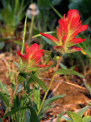
Ah, it seems summer goes so fast - the spring flowers were just coming up. Now, in midsummer, the garden gets a little crazy. The big bloomers are large and everyone is fighting for space. Every year the garden looks a little different and one flower seems to win "most in field". This year there are a quite a few Mexican Hat (Ratibida columnaris). These flowers are long-lasting and provide good color. They bloom in yellow or rust and sometimes a combination of the two. As a xeriscape flower, they provide a good, long-lasting bloom with little water and come back year after year.


Gaillardia pulchella commonly called Gaillarida or sometimes Indian Blanket, Blanket Flower, or Firewheel is one of the easiest and showiest of the xeriscape flowers - I highly recommend it for its color and long bloom. Indian Blanket Flower, the state wildflower of Oklahoma, is an impressive and beautiful native flower found growing along roadsides, in fields and pastures, sometimes covering large areas. Galardia pulchella seems to thrive in heat and is native from Colorado and New Mexico east to Minnesota, Nebraska, Kansas, and Louisiana and it is really putting on a show in the garden.


Wild sunflowers (Helianthus maximiliani) grow around here in profusion and as such are shunned from the garden, but I let a few come up every year. The wild variety is small with many flowers, not much like their domesticated cousins. I enjoy them very much, so do the Goldfinches. They roost on the branches and eat the flowers. We had a Goldfinch nest in our yard this year and they produced a couple of young.


In addition, the Russian sage (Perovskia) is in full bloom; its deep purple set off nicely by all of the yellow. At about three foot tall it is a garden staple and a long bloomer to boot. Russian Sage is classified as a sub shrub or woody perennial. It performs very well in full sun and any well-drained soil. Average to dry moisture levels are ideal, and few pests bother this plant. If pruning is necessary, do so in spring when new growth appears. Prune back to just above the lowest bud.


Although,yarrow (Achillea millefolium) is not really a prairie plant, I planted it anyway. It likes the heat, does well with the dry conditions and is very showy - especially with purples. I like its rusty yellow color and it too, is a long bloomer. The flowers are very quite large and are wonderful for cutting and drying although I usually end up leaving them in the garden. Deadhead the flowers for re-bloom and cut back to the basil leaf after bloom has finished. This flower was once used to flavor beer and has quite a few medical uses, but I have it for its color and longevity.

Saturday, July 21, 2007

Day Seven - Yellowstone


We got up fairly early and drove north to Mammoth only stopping a few times. We had already explored much of the road north anyway. We got a campsite close to town at the NPS area and went back in town for breakfast. What a great little town. Mammoth was really the first facility in YNP and has a long and interesting history. The town was first an early army facility and clearly shows those roots. It was, in fact, the first facility in YNP - first called Fort Yellowstone.

For the decade after 1872 when Yellowstone National Park was established, the park was under serious threat from those who would exploit, rather than protect, its resources. Poachers killed animals. Souvenir hunters broke large pieces off the geysers and hot springs. Developers set up camps for tourists, along with bath and laundry facilities at hot springs. Civilian superintendents were hired to preserve and protect this land from 1872 through 1886. The good intentions of these early administrators, however, were no match for their lack of experience, funds and manpower. Word got back to Congress that the park was in trouble and legislators refused to appropriate any funds for the park's administration in 1886.

The Army came to the rescue and in 1886 men from Company M, First United States Cavalry, Fort Custer, Montana Territory under Captain Moses Harris came to Yellowstone to begin what would be more than 30 years of military presence in Yellowstone.The first buildings of Fort Yellowstone were finished by late 1891. As more troops were needed, more buildings were constructed: officers' quarters, guard house, headquarters, barracks for enlisted men, stables for their horses and non-commissioned officers' quarters. In 1909, Scottish masons began constructing sandstone buildings here - among them the Albright Visitor Center (then the Bachelor Officers' Quarters) and the administration building (then a two-troop barracks for 200 men). The Chapel, the final building constructed during the Army's tenure, was also constructed of native sandstone. The stone from these buildings was obtained from a local quarry between the Gardner River and the Mammoth Campground.

The Army did much more than provide a police service. They built roads which still exist today and those roads are the first roads in the country build to a specification. The square building was the engineer's office.

The town is a nice little place, but we were keen on a hike . On the way there we saw a small brown bear. Still looking for the big grizzly! There was a trail leading to Albright Peak close to town so we set out for that. It was a hot day and a somewhat long hike, but we had a good time. One of the highlights of the day was running into a male blue grouse in a bit a mood to show off. He put on an awesome show and we frequently got within several feet of him to see it. Check out the pics on this guy in the slide show. He has these orange-yellow eye patches that make him look angry all the time - they have issues.

We also found a nice set of elk antlers. Their size on Bridger quickly illustrates the actual size of an elk. This is a big set.

Other than that it was a fairly uneventful hike. We finished and drove out of the park a short distance to Gardiner seeing another ungulate to add to the list - mountain sheep. (actually, Bridger did keep a running list of all the animals we saw - it became quite a list) It is one of the roughest towns I've ever seen, but we had good pizza. On the way back we spied a swimming hole/hot spring which we intended to hit up first thing in the morning. I must mention the massive north gate. It's quite a structure and a very large stone embedded in the top states, "FOR THE BENEFIT AND ENJOYMENT OF THE PEOPLE", and we were!

Sunday, July 15, 2007

Day Six


Well, after six days we're still showerless and heading into town! I'm sure the locals will love us. We got up early to drive to West Yellowstone (outside the park) to meet Astrid. On the way we saw a eagle sitting beside the Madison River. She had a nest nearby which looked like it had one chick which was rather large. The western part of Yellowstone is a bit drier and it begins to level out with the Madison flowing directly west. It however, doesn't flow into the Pacific. It is part of the headwaters of the Missouri which defines almost all of Montana and is the central and primary river basin.

We arrived early in West Yellowstone and called Astrid. We hadn't had any service most of the vacation and it was the first call. Well, long story short, Astrid was still in Missoula and will forever be known as squirrel girl. We were very sad not to see her. We did the most important thing first and found a coffee shop. Then saw a bit of the town, ate breakfast, had enough of civilization, and headed back to Yellowstone. We had found out through a friend about a swimming hole in the Firehole River and we headed for that. We knew it would be cold, but we stank enough for it not to matter. It was cold, but it was invigorating. I convinced Tammi to swim and of course Bridger was all over it. We were clean!

We changed and headed back toward Old Faithful stopping at Fountain Flats - a basin off maybe 1200 acres. (a calculation on satellite photos came up with the entire basin being 1543 acres) We decided on a hike around the area and headed out. Crossing the Fire Hole River by bridge we came across a huge buffalo herd which I believed to be about 500, perhaps as many as 1000 - it was hard to tell. The meadow itself stretched more than five miles long and a couple of miles wide and was surround by high volcanic cliffs on three sides. The buffalo herd surrounded the trail and covered the meadow. Most of the herd were napping and we actually walked through the mist of the seething mass. There were other people on the trail (actually an old road) and the beasts seemed quite ambivalent about our presence, but it was the heat of the day and the big boys were mostly bedded down - none were closer than about 20 yards. A few might have been closer, but we quickly passed. What an amazing thing to be in the center of a massive herd of bison. We were charmed and somewhat terrorized at the same time. I wish I could accurately describe it. Little did we know it would get plumb scary later.

We continued to walk and soon passed Goose Lake. At the far end an eagle sat on a dead tree having just finished a fish. We stopped and watched a while, but he refused to do anything exciting beside look regal so we moved on. We wanted to see Fairy Falls and headed in that direction. I hate to say it, but if you've seen Niagara Falls and Yosemite Falls everything else is somewhat anticlimactic. There were some hot springs noted on the map so I wanted to head that direction. There was no trail so off we went. Wow, what a treat. We found a very active geyser (Imperial Geyser) which went off every 45 seconds for about 20 or 30 seconds. It was very voluminous, tremendously loud - simply stunning. A deep, boiling pool of blue surrounded the geyser with several mud pots scattered around the perimeter. The frequency of the eruptions keep us there for quite some time and the best part - no walkways!

There was another nearby geyser (Spray Geyser) which was quite small, but boiled up in a constant osculating eruption. We decided not to return via the trail, but to follow the large meadow around on the south side. We came across the remains of two buffalo and one elk very graphically illustrating the importance of the bison in the food chain. It is hard to believe, but the wolves are able to take down the huge beasts, thus providing food for bears and lesser scavengers. The kills were old and we could not determine how the animals may have died, but the bones were stripped clean and white.

I have often heard the claim that bison are easier on the land than cows; therefore, it was very interesting to see the meadow as used by the bison. The herd seems somewhat pinned by the surrounding area and I suspect they seldom move, but I don't know this. Having grown up playing in the same fields with cows I am intimately familiar with what the fields "look like", and I found little difference between the two. The bison's hoof is somewhat smaller, but that also means they exert more weight in a smaller area. Some bison pies appear exactly as do cows, but some are much more consolidated, thus not killing the vegetation they cover. I suppose I would call it about half-and -half. As for grazing, it is about the same. The bison wander slowly forward, just as cows, leaving behind a similarly grazed area. The appearance, overall health, and general state of the meadow seemed to me, about the same. Of course, this isn't scientific, but I expect most of the claims are visual also and result more from an agenda than from fact.

Thus far, we had covered about 10 miles with about 2 miles back to the truck. It was getting on toward evening, the heat was abating, and we could see across the meadow that the herd was on the move and we aimed to miss them. I didn't want to be stuck in open meadow with something more than 10 times larger than me on our tails. The problem was we had to cross the bridge Firehole River so we were somewhat roped into a specific area. The bulk of the herd was located mostly toward the south and heading somewhat north. Being on the south of the meadow we crossed about a half-mile directly across the meadow so we could skirt them on the north and reach the bridge. There were a few trees there too and it seemed a bit safer. Once we got to where we needed to be the leading edge of the herd was pushing us away from the bridge. It was all we could do to make some progress in the right direction and still keep some reasonable space. And, wouldn't you know right in the middle of the chaos we ran across the most awesome bird I have ever seen - a pterodactyl. Well, it wasn't really, but it was huge - taller than Bridger, taller than the bison! It was a pair of sand hill cranes with two chicks. These birds have a wing span of almost 8 feet and they were giving the herd heck for being too close to the chicks. We so wanted to stop and take pictures, but the bison were moving fast, the cranes were stirring up the lead animals, and we were booking across the grass.

We found a break in herd and hightailed it for the bridge only to find ourselves surrounded and cut off with no way out but to make for the bridge through the herd. I, to this point, hadn't been too uncomfortable with the distance, but there were about 20 or so bison spread out nearby, of which about half-a-dozen were close to the trail. I grabbed Bridger's hand and foreword we went! I could have hawked a good loogie on any one of those six. One gave us the evil eye and a low grunt. That is, without a doubt, as close as I ever want to get to a volkswagon with legs and sharp horns.

We drove back to camp, ate dinner, and went to bed. It was a great day - perhaps the best so far.


Saturday, July 14, 2007

Day Five

One of the great things about camping is moving on everyday, but one of the bad is packing all the junk everyday. Today, no packing - we stay here for three days! So, up and out early heading north toward Manmoth. We didn't really have a day planed per say, but we did have some ideas. We weren't sure what we would find along the road - that usually, as we have found, fills up quite a bit of the day.

As always, and as we expected, there were the usual selection of hot springs, geysers, and thermal whatnots to explore, but we wanted something a bit more interesting and hands on. I saw some indications of some off-trail hot springs on the map and we wanted a bit of a hike so we headed to the Solfatera trail. We filled up on water and some food and strapped on the most important Yellowstone trail item - pepper spray. But, this isn't your grandma's pepper spray (that is, if she's a runner or habits biker bars). This is like a small fire extinguisher, shoots 30 feet and lasts seven seconds. It's industrial. This would put your average mugger into the ICU - it's made for bears; angry bears; big, angry grizzly bears with an attitude. If you have the presence of mind to use it, and use it right, it works quite well. I have a secret desire to use it, but only if everything is perfect; i.e. I see the bear coming, there isn't any wind, the bear has just eaten and simply can't hold another bite.

We walked about a half-a-mile and had our first "encounter". We came around the corner and smack in the middle of the trail was (no, not a bear) a very large bison of unusual size giving us the evil eye. You simply can't appreciate the size of a buffalo until you look them square in the eye with nothing between you and the tip of their horn. In takes very little imagination to imagine just where they might put it should they desire. We beat a healthy retreat, give the beast some space, and took some higher ground. We noticed that many of the big males tend to hang out, alone, away from the heard in these lush meadows.

Buffalo weigh about 2000 pounds, run about 30 MPH, and don't like strangers very much. It is estimated that in the mid-19th century there were up to 100 million wondering about. Everyone knows their sad story. Seeing them, wild, unfenced, and natural, was for me, the highlight of the trip. It took me back closer to the time of Bridger, Colter, and the mountain man. It made imagining unnecessary and actually put it to shame. Their massive bulk, the smell rising up, the sound of their breath and the depth of their groans put you squarely in the realm of the wild.

We walked a bit and smelled sulfur and soon the springs came into view. There was one other car at the trail head and we found three people it belonged to. They had gear spread out and it turns out a molecular biologist was collecting samples of the thermophiles in the boiling water.

It was fantastic to be able to walk around freely. All of the areas we visited thus far had wooden sidewalks and signs which keep the thermal areas pristine due to the volume of people visiting. The approach has worked well and the geysers and thermals were, it seemed, just as they would be if no one saw them, but this area didn't have visitors in any volume.

Prior to 1967 it was thought the highest temperature where photosynthesis was deemed likely and bacteria could exist was thought to be about 160 degrees F. At temperatures higher than this, it was a known fact that enzymes were destroyed. Boiling was considered a sure way to kill bacteria.

Imagine the surprise of researcher Dr. Thomas Brock when he discovered in 1967 a bacterium that lived at 176 degrees F in the Mushroom Pool of Yellowstone National Park. Dr. Brock's discovery opened up a new era in biology, which has resulted in the recognition of a third kingdom of life, Archea.This discovery also began the search for other organisms that might exist outside of our previously recognized limits, both on Earth and on other planets. Our understanding of the ability of life to prosper in a variety of environments has been vastly expanded, while our definition of "hostile environment" is shrinking. We now realize that there are organisms that "eat" sulfur, live kilometers beneath the surface in rocks, or even live near high-pressure, high-temperature, deep-sea volcanic vents. The possibilities for life now seem without bound. It all started in Yellowstone and these researchers were continuing the work. These extreme life forms color the water all kinds of crazy colors. Sometimes, where two different temperature streams meet one half will be green and the other half yellow until the temperatures combine to make a third color.

Dr. Brock placed a sample of the first bacterium that he discovered, Thermus aquaticus, in the American Type Culture Collection, where it became available to anyone wishing to study it. Later, in the 80s, a scientist working for Cetus Corporation used a sample of this species to develop a process that uses the high temperature stability of the enzymes in this heat-loving organism to perform polymerization of DNA in large quantities. This highly successful process is invaluable to modern medicine. Revenues from the patenting of this process have topped $500 million a year, but the tragedy is that none of this money has been funneled back to Yellowstone National Park.

In 1997, Diversa Corporation entered into a five-year agreement with the Park to collect samples of thermophilic organisms for a stated sum of money and a royalty on any patents issued as a result of their research. The organisms themselves were to remain part of the public domain but now the Park System would be able to benefit from the "intellectual property" obtained from research on these organisms. While cooperative research and development of a public resource was considered a controversial move, the agreement held up to legal challenges. As of April 2000, the Park is able to benefit financially from research on this bio-resource.

As we walked into the area devoid of vegetation (due to high ground temperature), Eagle-Eyed-Tammi spotted a large bear print. Because of the size, we thought grizzly. If you look closely you can see the bear had a cub whose print appears sideways in its mother's print. We spent about two or three hours carefully exploring the area. It's really amazing to bend down and feel the heat of the earth. The ground is so hot sitting lasts about 10 seconds and the steam vents burns instantly. The boiling water is, well boiling. We saw mud pots and little geysers, boiling streams, and all manner of thermal activity on a small scale. The small scale made it very accessible and close - it was unparalleled. The yellow crystals are what the inside of a steam vent looks like.

We hiked back to a small lake, circled around and headed back to the car. That had taken most of the day so we headed back to camp. We wanted an early start the next day as we were going to drive out of the park to meet a friend; Astrid, who was coming from Missoula down to meet us.

Thursday, July 12, 2007

Kind of neat!


One of my interests is astronomy and perhaps this might get you interested. Some cosmologists need help to classify galaxies and you can sign up and help on the web. There are something like a couple of million to classify and I guess they got a bit tired of it. Many hands make light work. Basically, you will be the first person seeing about 100% of what you see and categorize.

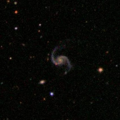
Apparently, the human brain is much better at recognizing patterns than a computer. Here is a shot of several of the ones that came up on my screen. You are seeing them for the first time (well...second time). The first is a spiral clockwise galaxy. I have no clue where. See my post on the milky way for some perspective on just how big things really are. Imagine several million Milky Ways...no, not the candy bar - our galaxy.

Here's the site.


Wednesday, July 11, 2007

Better?......perhaps!

I know, I'm an inconsistent poster. I know some of you like the blog, but don't know when I post, etc..etc...

I found a better way. There is a new tool on the site which will send you an email only when I post something new. Try it, let me know if it doesn't work - I can never tell if HTML is correct. Hopefully this will be better than checking the site and being crushed by the fact that there is nothing new!

The little widget seems to be easy - you have to register and confirm with an email reply.

Wednesday, July 04, 2007

Puppy - The One!


Well, the puppy is picked. We brought him home on Sunday. He's "stop you dead in your tracks" cute. Now, the name.....

We had been thinking about names for quite a while. A Google search proved helpful, but as usual there were just too many choices. We wrote down quite a few, but we wanted the name to match the little booger. Chewbacca was a contender, but didn't make the final cut.

Once home Bridger settled on Strider; the name of the Ranger in the Lord of the Rings who eventually became King of Gondor. Bridger desperately wanted Tintin; as in Tintin and Snowy by Herge. He has been reading those a lot, but he didn't know about Rin Tin Tin and the fact that it was a common dog name. We kept forgetting Strider and calling him Shredder, but Bridger didn't like that name very much.

Somehow, after a day or s0 we came up with Colter and it stuck. (I swear I didn't plan it) Bridger liked it - he said now Bridger and Colter are together again. So, now the little chewing rogue has a name, which by the way, he seems to have gotten used to it already.

The pictures tell it all... I've got to go and clean up an "accident".

Day Four


We got up early in Colter Bay at Jackson Lake in the Tetons to head for Yellowstone. We didn't have grand plan, but we did know that camping spaces were often limited. We also had to be in West Yellowstone to meet a friend at a certain time so we wanted to head that direction to ensure we had a camping spot. Our usual "camp anywhere" approach doesn't work in Yellowstone. The drive up somewhat follows the Snake River whose headwaters are located in Yellowstone. It eventually becomes the main tributary for the mighty Columbia River and then flows into the Pacific. The lower Snake was first explored by Lewis and Clark and was first known as the Lewis River. Most likely Colter was the first to explore the upper Snake and the road would have roughly followed his route - at least in Yellowstone Park.

The southern entrance road is heavily forested with lodgepole and is not particularity scenic. We crossed the Continental divide three times at about 8000 feet (now eight times total) and dropped down into Old Faithful. It is, or course, a must see, but because of the number of visitors everything is "sterile", and there are people everywhere. Old Faithful was awesome and we enjoyed the surrounding geysers and springs, but I must say we enjoyed the back-country hydrothermal features a lot more.

Ok, now it's time for your geology lesson. In order to really appreciate, see, and understand Yellowstone it is necessary to understand the geology. The most striking, and obvious aspect of Yellowstone is the relative nearness of magma to the surface. Yellowstone is located in an active Caldera - yes, I meant to say active. That is, of course, in geologic time. Parts of Yellowstone have risen more than three feet in recent years due to the magma chamber located under Yellowstone rising. Of course, the theories as to why and how are all simply conjecture, but the end result is undeniable. The past, also undeniable, and is etched around most of the lower 48. What is located under Yellowstone is called a "hot spot". Such hot spots are located around the globe and include places like Hawaii, the Galapagos, and Iceland. The volcanic activity has nothing to do with plate tectonics - they are simply places where earths crust is "thin". These hot spots "move", or at least the crust moves in relation to the hot spot, and the Yellowstone hot spot has moved also. This is referred to as a hotspot track. The old calderas can be located on a west-south-west line stretching across the western US.

You may have noticed that I referred to the Yellowstone Caldera affecting most of the lower 48. Some of the older eruptions may have snuffed out most life in the entire US with an order of magnitude somewhere around 2000 to 3000 times that of Mt. Saint Helens. Ash was deposited many feet deep for thousands of miles. What wasn't wiped out by the initial event was killed by a "volcanic winter". The most recent, the Lava Creek eruption, occurred about 640,000 years ago and deposited tuff now about 1000 foot deep locally. (Tuff is consolidated ash with all kinds of volcanic material mixed in)

The complete picture of the volcanism is complicated and beyond even what I want to read about, but this quick outline should give you some idea about this supervolcano. It is not completely understood and is still studied extensively, but the point is that it is massive - wipe out the entire US in a heart beat massive.

The next interesting thing to know about Yellowstone geologically is the two most recent glacial periods and the effect on the topography. Perhaps it is first best to know what these glaciers were not. They were not alpine (or piedmont) glaciers and they were not continental glaciers. They were ice caps similar to modern day Greenland. Again, the scale exceeds our ability to readily imagine the size. The Pinedale Period (the most recent) wasn't that long ago (about 25,000 years at its peak), so the marks are still very clear on the landscape. Although there were many glacial periods we can only really see the last two - the Pinedale and Bull Lake. They are similar, but the Pinedale partially obliterated the Bull, so I will discuss the Pinedale Period.

If you went back to the peak of the Pinedale Period and stood on the Grand Teton you would see the terminus of the ice cap that covered Yellowstone. The entire valley would be covered by glacial till (rocks and silt), glacial melt would be cascading off and thundering from under the ice and immediately creating a river much larger than the Snake is now. The mountains of gray silt and the bolder fields would almost be uncrossable. Descending and walking north you would be walking on only the glacier - quite steeply at first, then almost flat. Standing in the center of Yellowstone you would have about 4000 feet of ice below your feet. The only visible land would be the Absarokas to the north. You would have to walk several more days back down the glacier north to escape the ice, and you would have traversed about 120 miles. The ice cap was enormous and all of the features it left are easy to see today - eskers, kames, terminal and lateral moraines, glacial striations, drumlins, erratics, and many other things.

There is one place in Yellowstone Canyon that has one of the best geologic views I have ever seen. As you look across the river cut (almost a slice) the far side has glacial till many feet deep on the top. Immediately below that is about 60 feet of basalt that formed in hexagonal columns. These are always neat just by themselves. These dark columns lie directly upon another layer of glacial till - really round stones of about equal sizes surrounded by glacial flour. The layers mark a period of glaciation, a period of volcanic activity, and another period of glaciation.

Back to the trip. We drove west, toward the west entrance, stopping at every pullout to check out the geysers, springs, and thermals. They are really awesome, and we took about 100 pictures. We camped at Madison Junction walking around the meadows and checking out the buffalo before turning in. We were to stay here three days so we set up the tarp, cuts lots of wood, set up an extra tent, and generally made ourselves more home than usual.

Tuesday, July 03, 2007

Break in Vacation posts for, well... Vacation

This intermediate post interrupts the regularly scheduled vacation post for several reasons. One, we were on vacation in Crested Butte and secondly we picked up the puppy on the way home. I just didn't have enough time to post about vacation while on vacation and there was lots of fun and of course, the puppy is big news.

First Crested Butte, as always the place was terrific. We had a good time hanging out with some of the family. Tammi and I got to ride Trail 401 (pictured here), the most celebrated mountain bike trail in Colorado. There might be better trails, but not many - this is the creme da la creme; simply as good as it gets. We did 29 miles door to door and we were trashed. We haven't gotten out as much as we would like.

Crested Butte is a great town and we did a lot of hanging out. There was a mountain bike fest and all the craziness surrounding such an event. A big black bear walked by the deck one morning - the kids loved that. I think Traci and Owen really liked the trip down too. An accident closed the highway forcing a detour on their return home so they see Cottonwood Pass, Schofield Pass, Paradise Pass, Hoosier Pass, and Loveland Pass - it was an all day detour!


I also got in a fair amount of climbing with Owen, my brother-in-law; who I met Tammi through. We used to climb together a lot, so it was great to be roped up with him again. I hope we can do it some more. We ended up climbing the Bastille in El Dorado Canyon yesterday - felt like old times. It is a old school 5.7 put up by Layton Kor in the 70's. The Bastille is shown at the right and is just what you might expect - a large prow, and here's a picture of the crack. The first three pitches are a real joy. It is the most famous of the climbs in El Dorado.

Anyway, we had a great time with Owen and Traci and kids. I'll post about the puppy in a separate post.

Leave A Comment

Hey! Leave a comment - good, bad, short, long, whatever. I'd like to hear from you.